All links on this page are to PDF files administered by this web site or other pages on this web site. Please move your cursor over cited references that will turn blue showing they are active. You are encouraged to review information in the links.
Idaho Irrigation District and New Sweden Irrigation District (Districts) are promoting the County Line Hydroelectric Projects (CLHP). A description of the CLHP is contained on the Project description page of this web site. The Osgood Reach refers to the portion of the Snake River near County Line Road affected by the CLHP. The 3.5-mile Osgood Reach is the last stretch of Snake River with a natural flow gradient for over 40 miles from north of Roberts to Firth. Numerous private residences exist along the Osgood Reach. The Osgood Reach is accessed by the public via boat ramps located downstream.
The Districts are proposing to divert up to 2,000 cfs (cubic feet per second) of water around the Osgood Reach, run this water through their two proposed hydroelectric turbines (maximum 1,000 cfs each) and return it to the river. Districts submitted a License Application to the Federal Energy Regulatory Commission in which they request that the FERC allow them to divert water to hydroelectric turbine feeds provided at least 1,000 cfs flow remains in the Osgood Reach. Minimum remaining reach flow is referred to as “minimum bypass flow” or “MBF”.
The FERC rejected Districts’ proposed 1,000 MBF in lieu of the following per Draft License Articles contained in the FERC Draft Environmental Assessment (DEA) issued on September 7, 2022:
- 3,500 cfs MBF from May through August,
- 2,500 cfs MBF during September and October, and
- 1,500 cfs MBF from November through April.
The following graph shows the proposed FERC licensed MBF flows in context of other Osgood Reach flow thresholds. All of the items shown in the graph are explained in detail elsewhere under the “CLHP Impacts” tab of this website.
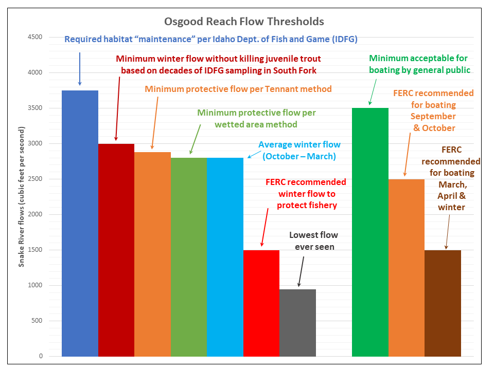
The following are brief descriptions of data contained in the above chart:
- 3,750 cfs minimum flow required to protect river habitat during the winter recommended by the Idaho Department of Fish and Game (IDFG) in 1999 (PDF file reference: Managed Recharge Report (10MB) page 64);
- 3,500 cfs minimum flow deemed acceptable for recreational boating by the public who don’t possess experience in navigating the reach (link to website tab: Impacts on Recreation); FERC draft license articles set this as minimum flow from May through August
- 3,000 cfs threshold below which juvenile trout overwinter survival declines based on decades of empirical data sampled on the South Fork by the Idaho Department of Fish and Game (link to website tab: Impacts on Recreation);
- 2,880 cfs minimum flow required to protect river habitat determined per the Tennant method (link to website tab: Tennant Method);
- 2,800 cfs minimum flow required to protect river habitat determined per a wetted area analysis (link to website tab: USGS Wetted-Perimeter Method);
- 2,800 cfs historical mean winter flow from October through March
- 2,500 cfs minimum bypass flow FERC proposed in draft license articles for recreational boating during September and October…this flow well below flow required for recreation by the general public;
- 1,500 cfs minimum bypass flow proposed by FERC from December through April per the draft license articles;
- 950 cfs lowest flow ever seen in the Osgood Reach.
FERC asserts in the DEA that lowering reach flow to 1,500 cfs MBF is protective of the fishery and wildlife during the winter based on habitat suitability model results that are refuted by empirical data (that is, data actually measured in the field) that clearly shows raising flow increases overwinter trout survival . FERC omitted all empirical data from the DEA. FERC’s proposed licensed flows will adversely impact boating recreation during March, April, September, October and throughout the winter.
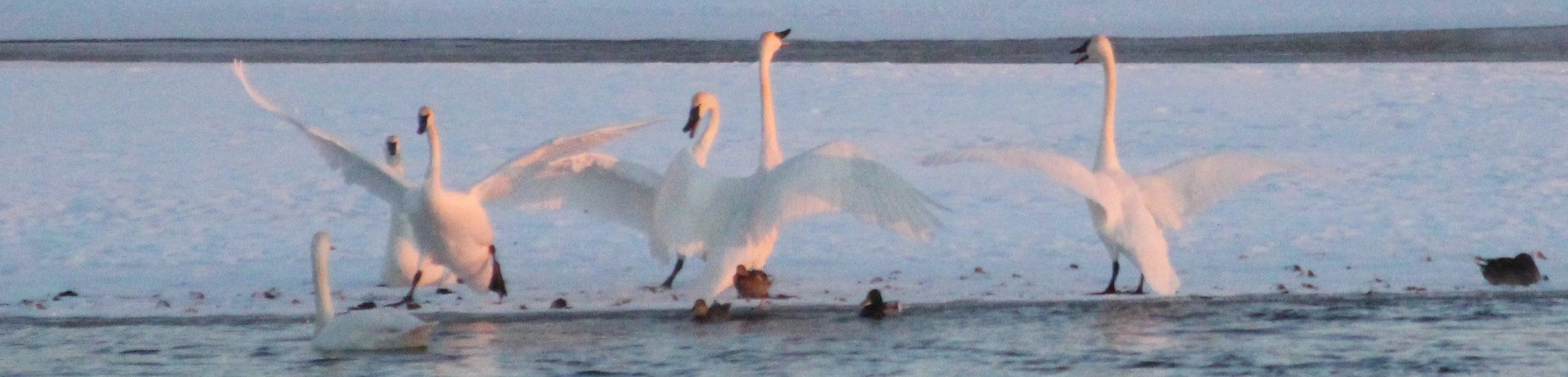
FERC did not completed a credible analysis of project impacts on waterfowl that frequent the Osgood Reach in large numbers during fall and winter.
Upper Snake Advocates believes that FERC’s proposed licensed reach flows are not in the public interest since they will cause unacceptable harm to the environment and recreation. Please go to the Sign Petition page and add your name to the list opposing the CLHP if you agree.